|
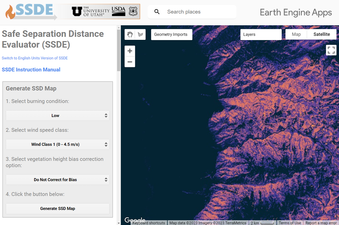
Building the Safe Separation Distance Evaluator (SSDE)As discussed below, safety zones are among the most important tools available to wildland firefighter to avoid burn injury or even fatality. Yet knowing where suitable safety zones are on the landscape remains a persistent challenge. We built an open-source tool in Google Earth Engine that allows anyone to identify and evaluate the relative suitability potential safety zones anywhere in the US. Firefighters and incident managers can use this tool to aid in the selection of safety zones in advance of a wildland fire, increasing the efficiency, reliability, and consistency of the safety zone evaluation process.
Click here to access the published paper. |
Developing the Escape Route Index (ERI)
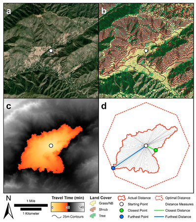
The efficiency with which wildland firefighters can evacuate the fire line and get to a safety zone is dictated largely by terrain and vegetation conditions. The difference between a fast escape route and a slow escape route can be the difference between life and death in a wildland fire environment. In order to avoid injurious or life threatening situations, it's important to direct firefighters towards locations where they have the capacity to safety and quickly evacuate if necessary when managing a fire. To that end, we introduced the Escape Route Index (ERI), a spatially-explicit measure of relative egress capacity based on surrounding landscape conditions that ranges from 0 (very low egress) to 1 (ideal egress). Applying this algorithm prior to engaging a fire can provide fire crews with a critical piece of safety information that can facilitate a more informed decision-making process.
Click here to access the published paper. |
|
|
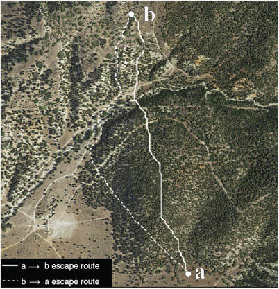
Using Lidar to Model the Effects of Landscape Conditions on Escape Route TravelAnyone who has gone hiking or has bushwhacked through the woods knows that there are a number of factors that control how fast you're able to move on foot through a given environment. Steeper slopes are going to slow you down. Trying to move through dense vegetation is going to slow you down. Traversing uneven or rough ground surfaces is going to slow you down. Intuitively, we know these, but quantitatively, we have very little information to tell us just how much these landscape conditions slow us down. In order to allow fire crews to select maximally-efficient escape routes, we experimentally tested and determined the effects of lidar-derived estimates of slope, vegetation density, and ground surface roughness on travel rates.
Click here to access the published paper. |
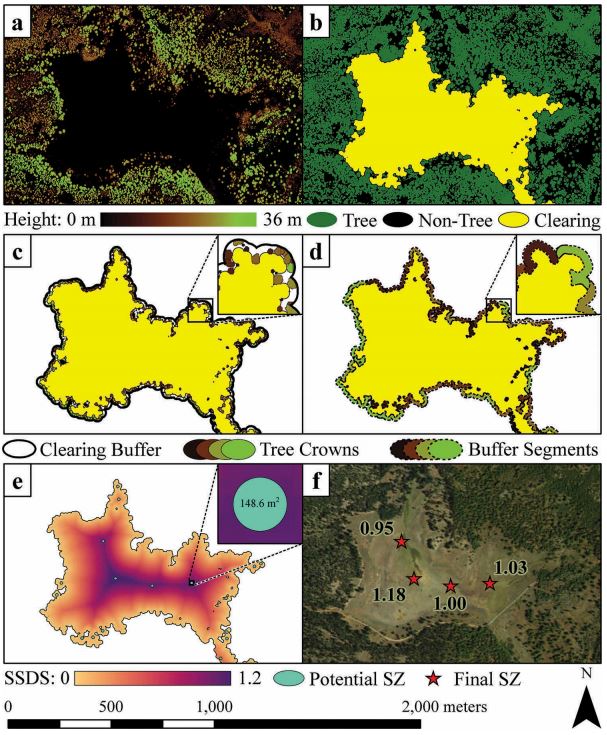
Mapping and Evaluating the Quality of Safety Zones using Lidar
Escape routes are only as good as the safety zone they lead to. Safety zones are areas devoid of flammable material that wildland firefighters can evacuate to in a dangerous situation to avoid bodily harm. However, like escape routes, there are good safety zones and there are bad safety zones. Their relative effectiveness is controlled largely by three factors: (1) their size -- they need to be large enough that firefighters can maintain a safe distance from surrounding flames; (2) the height of the surrounding vegetation -- taller vegetation means more fuel, and more fuel means a hotter fire; and (3) their slope -- fire likes to travel uphill, so you don't want a safety zone to be up a steep hill from the fire. Fortunately, these three factors are easily mapped using lidar! We developed an algorithm to automatically identify and assess the relative quality of safety zones on a broad spatial scale. The application of this algorithm allows fire crews to have a map ahead of time of all potential safety zones in proximity to a fire.
Click here to access the published paper. |
|
